Enchanting village with breathtaking scenery
Capracotta, with its altitude of 1421m a.s.l., is one of the highest municipalities in the Apennines, as well as being a captivating village, nestled on the border with Abruzzo among coniferous forests, mountains and streams that create an amazing landscape.
It is therefore an ideal location for practicing various sporting activities out of doors, either in the winter months or in summer; the territory has many trails for trekking, and offers ski enthusiasts both cross-country and downhill slopes.
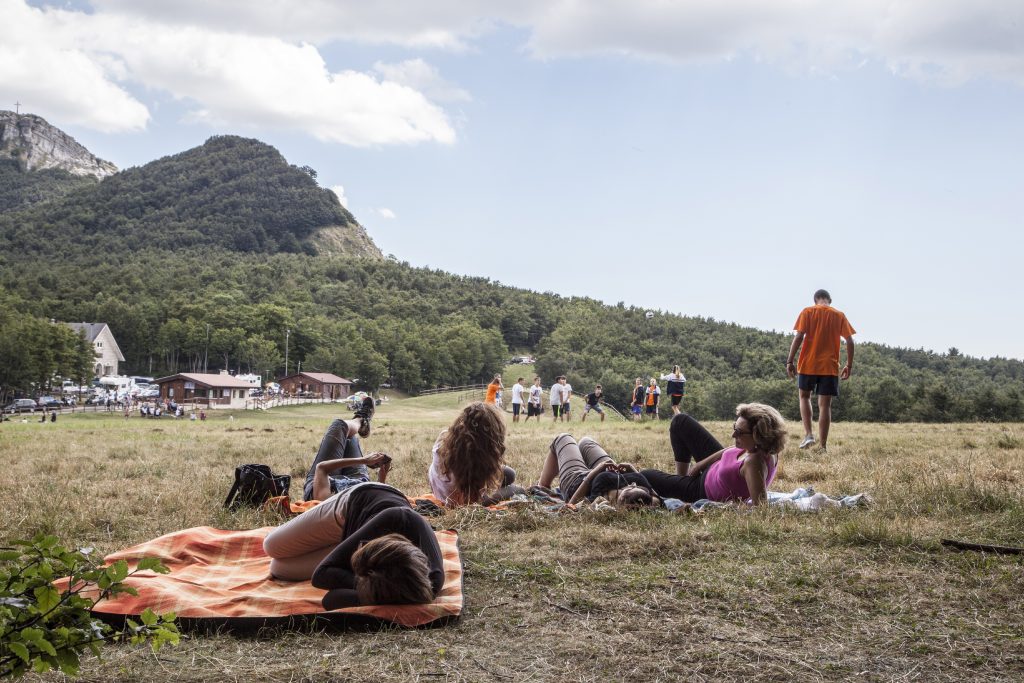
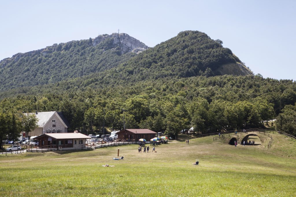
Just 3 kilometers from the village is Prato Gentile, a plateau immersed in beech woods, which features the “Mario Di Nucci” cross-country ski trail, one of the most attractive on the national scene.
In addition the winter touristic facilities on offer in Capracotta were completed in 1997 when an area for alpine skiing was built along the slopes of Monte Capraro. In particular, a medium difficulty track (red) with sections suitable to meet the needs of all skiers was built. You can also venture onto various off-piste tracks where the snow is always perfectly beaten down. The excellent northern exposure of the main trail always gives you sufficient snow of the best quality in the incomparable setting of a beautiful beech wood.
A ski lift with a capacity of 720 people per hour, serving the upper part of the red slope (from 1570 to 1650m a.s.l.) lets you ski for a distance of about 450 meters in guaranteed ski conditions. Beginners have the opportunity to take their first steps on skis by leaving the chairlift at the intermediate station and taking a section of blue track that is about 300 meters long.
Up above the track there is a refreshment ski lodge with services, whre you can taste typical local products. There is also a ski lodge with refreshments further down the valley.
As for the trails, they vary both in terms of the level of difficulty and the time needed to cover them. Everywhere they look, hikers will be able to see natural wonders, and admire the Mainarde chain of mountains that is over 2000 meters high, as well as the Massiccio of the Maiella, the Trigno valley, and the Matese.
| Path 309 – Prato Gentile – Cross-country ski path “MARIO DI NUCCI” Difficulty: Turistica Length: km 7,40 Travel Time: about 2h e 30’ Difference in altitude: m 66 It can be travelled all year round, even in winter with cross-country skis or with snow-shoes |
Path 310 – M. Campo – M. San Nicola – guado della cannavina Difficulty: Escursionisti Length: km 15,1 Travel Time: about 4h e 30’ Difference in altitude: m 478 When there is snow it can be covered with snowshoes, if you are equipped with GPS or accompanied by a guide. |
| Path 312 – cese-procuoio-guado spaccato Difficulty: Turistica Length: km 4,73 Travel Time: about 2h Difference in altitude: m 202 It can be travelled all year round, even in winter with cross-country skis or with snow-shoes |
Path 313 – pineta s.giovanni-fonte sambuco-prato gentile Difficulty: Escursionisti esperti Length: km 5,54 Travel Time: about 3h Difference in altitude: m 329 Not advised in the winter months when there is snow. When there is no snow, it can be covered if you are equipped with GPS or accompanied by a guide. |
| Path 314 – Muro don giulio- sotto la terra-incrocio sentiero 335 Difficulty: Turistica Length: km 2,90 Travel Time: about 1h 30’ Difference in altitude: m 174 Not advised in the winter months when there is snow. When there is no snow, it can be covered if you are equipped with GPS or accompanied by a guide. |
Path 331– pioppi-parco fluviale del verrino-santa croce Difficulty: Escursionistico Length: km 10 Travel Time: about 4h 30’ Difference in altitude: m 325 It can be travelled all year round, even in winter with cross-country skis or snow-shoes. |
| Path 332– sotto il monte-la crocetta-fonte la netta Difficulty: Escursionistico Length: km 5,84 Travel Time: about 2h 30’ Difference in altitude: m 159 When there is snow it can be covered with snowshoes, if you are equipped with GPS or accompanied by a guide. |
Path 333– sotto il monte-fonte dell’orso-la crocetta Difficulty: Escursionistico Length: km 5,76 Travel Time: about 2h 30’ Difference in altitude: m 161 It can be travelled all year round, even in winter with cross-country skis or snow-shoes. |
| Path 334 – sotto il monte-piana del monte-raccordo sentiero333 Difficulty: Escursionistico Length: km 2,8 Travel Time: about 2h Difference in altitude: m 283 When there is snow it can be covered with snowshoes, if you are equipped with GPS or accompanied by a guide |
Path 335 – sorgente del mulo-tre confini-sotto il monte Difficulty: Escursionistico Length: km 8,62 Travel Time: about 3h e 30’ Difference in altitude: m 387 Not available when there is snow, accessible with GPS or accompanied by a guide. |
| Path 336 – sotto il monte-piana del monte-raccordo sentiero333 Difficulty: Escursionistico Length: km 4,30 Travel Time: about 2h e 30’ Difference in altitude: m 398 Not available when there is snow, accessible with GPS or accompanied by a guide. |
Path 350A – PIAZZA FALCONI-sotto il monte-LA CROCETTA Difficulty: Escursionistico Length: km 6,98 Travel Time: about 3h e 30’ Difference in altitude: m 357 Clothing suitable for the season and training or trekking shoes are recommended. |
There are also different trekking routes for expert hikers. The marked ones are of a simple tourist type and are found mainly along the cross-country ski trails between firs and beech trees typical of the area.
Clothing suitable for the season and training or trekking shoes are recommended.
