The municipality of Pescopennataro (from “pesculum”, rock), about 14 km away from the town of Agnone, is located at an altitude of 1200 m a.s.l., set in an area that is particularly suited to the environment and very impressive with its elevated position overlooking the valley of the Sangro River
Known as the “village of stone” because of the presence of many stonemasons, it originally stood at the highest point on the rocky peak, in a defensive position.
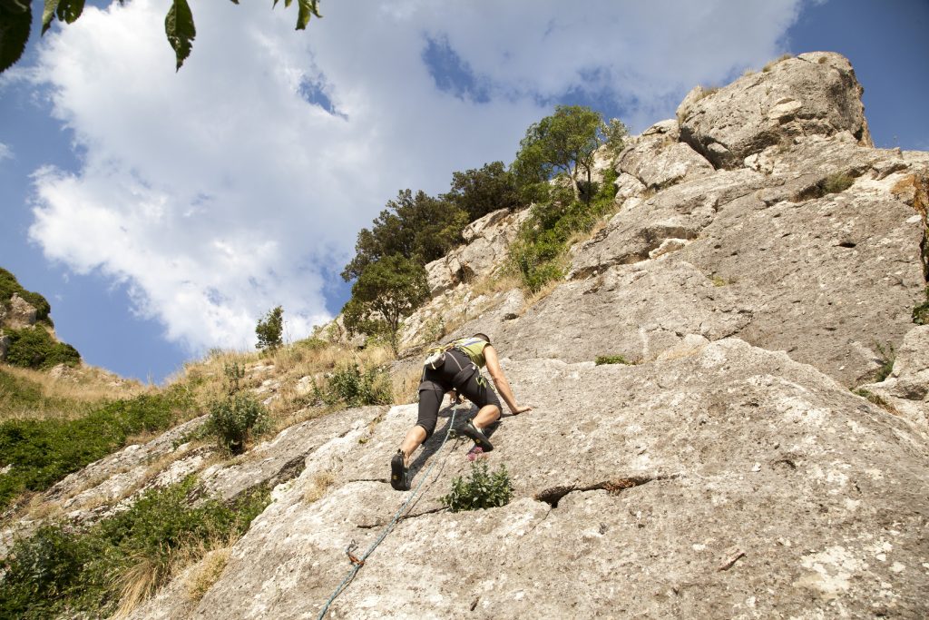
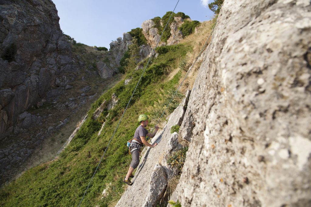
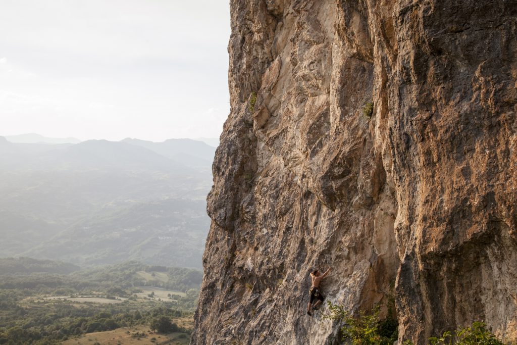
It is possible to practice the sport of climbing on the challenging limestone walls (mainly single pitch with degrees that start from the 4th and reach the 7th); the cliff is a real paradise that can satisfy the needs of the most sophisticated climbers, but is also suitable for those who prefer slopes of more moderate degrees.
It is also known as the “village of firs” because most of the territory is covered by forests of white fir (Abies alba), a very rare species in the Apennines and the surrounding area.
There are two SIC (Sites of Community Interest) found in the municipality: that of the forest of the “Vallazzuna” and that of the forest of the “Abeti Soprani”. Many nature paths branch out for visitors who love to immerse themselves in lovely, natural scenery, perfect for trekking that is not very demanding but fascinating all the same.
Not far from the town, among maples, beech and firs, are the sources of the Rio Verde mineral waters, much appreciated by the guests who want to take a trip out of town to be completely surrounded by nature; it is also possible to enjoy the picnic and refreshment areas.
For trekking enthusiasts there are the following paths, all within the borders of the municipality:
| S1- S.Luca Type: Panoramic-Naturalistic-Religious Total length: 1.8 km Average travel time on foot: about 40 min Difficulty: medium Mode of travel: on foot |
S2- La Morgia – Abeti Soprani Type: Panoramic-Naturalistic Total length: 3.1 km Average travel time on foot: about 1 hr Difficulty: low Mode of travel: on foot, on mountain bike, on horseback |
| S3- Abeti Soprani Rio Verde Type: Panoramic-Naturalistic Total length: 1.6. km Average travel time on foot: about 30 min Difficulty: low Mode of travel: on foot, on mountain bike, on horseback |
S4- Grotte Castellana Type: Panoramic-Naturalistic Total length: 8.6 km Average travel time on foot: about 2 hr 50 min Difficulty: low Mode of travel: on foot, on mountain bike, on horseback |
| S5- Ciandrea Type: Naturalistic-Geological Total length: 2 km Average travel time on foot: about 40 min Difficulty: low |
S6- Monte Campo Type: Panoramic-Naturalistic Total length: 1.5 km Average travel time on foot: about 30 min Difficulty: medium-high Mode of travel: on foot |
| S-7 Tratturo Ateleta-Biferno Type: Historical-Naturalistic Total length: 3.8 km Average travel time on foot: about 1 hr 20 min Difficulty: low Mode of travel: on foot, on mountain bike, on horseback |
S-8 Fonte della Gallina- Abeti Soprani Type: Naturalistic Total length: 4.3 km Average travel time on foot: about 1 hr 30 min Difficulty: low Mode of travel: on foot, on mountain bike, on horseback |
| S-9 La Pescara-Abeti Soprani Type: Naturalistic Total length: 4.3 km Average travel time on foot: 1 hr 30 min Difficulty: low Mode of travel: on foot, on mountain bike, on horseback |
S-10 Abeti Soprani- Laghi dell’Anitra Type: Naturalistic Total length: 1.8 km Average travel time on foot: about 40 min Difficulty: low Mode of travel: on foot |
")